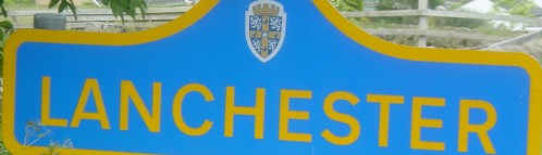
Road sign into Lanchester
Lanchester Parish extends from Burnhopeside Hall in the east to beyond the A68 road in the west and from just past Ornsby Hill in the north to near Quebec in the south. It is centred on the large village of Lanchester, near to which are the small hamlets of Malton, Hurbuck, Hollinside and Ornsby Hill.
Lanchester village is situated in a valley within the eastern foothills of the northern Pennines, in a landscape of mainly pasture and woodland.
There are several Sites of Nature Conservation Importance, Ancient Woodlands and local nature reserves located within the Parish together with an Area of High Landscape Value, an Area of Outstanding Natural Beauty and some Historic Parkland.
The Smallhope Burn, a tributary of the River Browney, flows through the Lanchester Valley to join the Browney near Malton. The river then flows on to join the River Wear outside Durham City. The valleys of the upper Browney and its tributary Rippon Burn include extensive woodland. Generally the areas further to the west are more open with limited hedge and tree cover as the land rises towards the Pennines.
The Lanchester Valley is generally broad, but where the village is sited the sides are steep and the valley bottom is only 200m wide. Here the land is 115m above sea level but it rises to 200m towards Burnhope to the east and Hollinside, Cornsay and Square House to the west and south. The open undulating countryside further to the west continues to rise to 250m – 300m near the A68 road.
The steeply rising hillside on the north of the valley is pasture, with broad-leaved woodland in the vicinity of the village and larger conifer plantations on the upper slopes. Much of the remainder of the countryside is also pasture, but there is significant replacement woodland on Ragpathside and there are shelterbelts north of Newbiggin Lane following opencast coal mining.
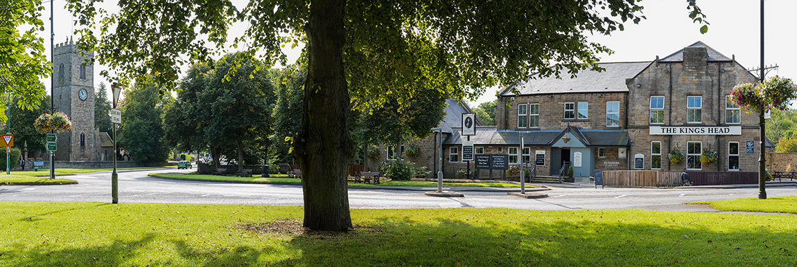
Lanchester is an old settlement – the Roman camp bears witness to this – and it is probable that there was a settlement here when they arrived. The Parish Church was begun in the 12th Century and the village centre still shows all the hallmarks of one of Durham’s country market villages – the cattle mart behind the King’s Head survived until the 1970s.
The modern village began to develop with the arrival of the workhouse and the railway in the 19th Century, and the latter part of the 20th Century saw major expansion with both private and local authority housing developing on all sides of the original core. Much of this development is on the lower slopes of the valley sides. These slopes make for difficulties for elderly and infirm people. The old village centre continues to be the economic heart of the community, with almost all the shops and services located here and all the bus routes calling.
The post office, two banks, a butcher, baker, greengrocer, hardware shop, small super-market, two opticians, pharmacy, florist, carpet shop, pet shop, three hairdressers, insurance and solicitors’ offices and a fish and chip shop, italian restaurant, together with Chinese and Indian take-aways are all found in the village centre – as are the offices in which the Parish Council meets.
There are also three schools, three Churches, three pubs and a car repair garage. It is an unusually active community – there are over seventy village organisations which receive consistent support and all three churches have built very high quality extensions in the last fifteen years, which is a mark of their active contribution to the Parish. The Community Centre is also much used.
The population of the Parish at the 2001 census was given as 4,382 of whom 3,697 lived in the village itself. 703 people lived outside the village (16%). In the Parish as a whole 21% were over 65 years of age and 26% under 25 years. Nationally the comparable percentages are 16% over 65 (17% in Derwentside) and 31% under 25(30% in Derwentside). The national trend is for the older age group to be increasing and the younger decreasing. This suggests that local monitoring should be maintained if the provision of services is to match this changing population.
This is an edited version of the Village Profile in the Lanchester Parish Plan 2006.